


One of the highlights of Developer Day in Australia was the "speedgeeking" final. (I'm not sure why we chose that name - I might ask someone in our Events team).
We showcased 6 of the best Australian Google Maps "mashups", with everyone in attendance voting for the winner. (For the uninitiated, a Google Maps "mashup", is a website or application that uses the free Google Maps API, and other data, to present information on Google Maps).
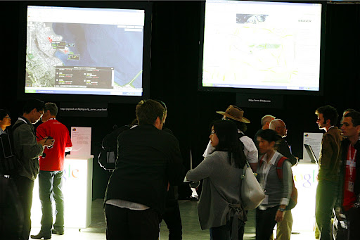
Voting on the Finalists
The 6 finalists, chosen from hundreds of great Australian mashups, were all fantastic. The 6 sites deliver innovative and useful content to worldwide audiences. Some have commercial application, others are just great fun. Each mashup was displayed on a large screen, with attendees able to explore and interact with the site via a laptop.When the voting was all said and done, the winner was PropertyGuru.
 Properties for sale in Dianella, WA on PropertyGuru
As described by its creators:
PropertyGuru is a map driven real estate search engine, comprising of homes for sale throughout Australia. It features an intuitive interface, powerful search and property comparison tools. PropertyGuru was designed to alleviate the frustration experienced when buying a house. It allows the home buyer to locate potential properties by moving an interactive Google map to any area in Australia, bringing up pins for properties that meet their budget and requirements.
The site is complemented with many research tools such as suburb median prices to ensure that your next home purchase is at the right price.
With a comprehensive view of the property market, PropertyGuru.com.au is the best way to find your dream home.
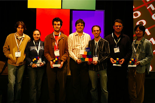
Well done guys! (they're the ones in the middle with the slightly bigger trophy). Google is really pleased to provide developers with free tools and APIs on which amazing Australian websites can be based.
The other 5 finalists, all top sites I'm sure you'll agree, are detailed below (in their own words).
Bikely
Put very simply, Bikely helps cyclists share knowledge of good bicycle routes. It can be tricky traversing a car dominated city by bicycle, particularly when you need to travel an unknown route to a new destination. But the chances are, someone has cycled that way before you. Bikely makes it easy for him or her to show you the best way. Bikely is not about mapping technology - it's about leveraging community knowledge to make cycling safer and more fun.
Remember the Milk
Remember The Milk is an online task management service used by over 200,000 people which builds on a number of Google APIs. A Google Maps mashup allows users to visualise where tasks are located in the real world, and includes cool features such as filtering by time and clustering by zoom level. With the Google Gadget, users can review and manage their tasks from iGoogle. Remember The Milk also integrates with Google services by providing task management in Google Calendar (including another Maps mashup), and sends reminders via Google Talk. The service is available in 21 languages.
planOfile
planOfile is a trip collaboration system allowing users to publicly and privately share their trips on map browsers. It works for any type of trip: air travel, driving, sailing, bush walking etc... Users can minimize planning effort by including published trip legs for airline flights, bus tours, etc... Users can create events that allow attendees to add their own trip information, effectively providing a visual calendar for the event. e.g. reunion, family Christmas, fly-in etc...
Organisations can view past, present and future location of resources. e.g. Who is overseas today and when will they return?
FGMap
FGMap is a Google Map web app. developed to be used with FlightGear, a cross-platform open source flight simulator. It was first written to show air traffic on the FlightGear multiplay online server in real time. You can find out who (in the game) is flying online, and where in the world he or she is flying on the map. It was then extended with the capability to display "navaids" such as airport/runway data, radio navigation, and landing guidance.

Cannonade (The Patrick O'Brian Mapping Project)
Patrick O'Brian's series of twenty one novels, set in the Napoleonic age of sail, are the basis for this project. Despite the fictional nature of the series the plot is inspired by, and overlaps with, real historical events and the narrative often refers to real locations and even actual longitudes and latitudes. A minute examination of the text is used to find each reference to physical location, ship's course; wind direction and speed. I have interpreted these references and translated them into map markers. Marker info dialogs can include a quote that justifies position, a description and an image. Markers also have a concept of context so forward and back links (in the info dialog) can be used to iterate over the story.
We'll showcase more great Aussie mashups on the blog soon. Soon, we hope that some of these will be available on Google Maps itself, via the newly released Mapplets (still in Developer preview mode). More on that soon too!


No comments:
Post a Comment